What do we learn from stranded marine mammals - and from tracking them after they are rehabilitated and released? In short, a lot!
Over the past few months, SeaDoc partnered with multiple other organizations to help a young Steller sea lion pup that stranded off the coast of Washington State. The effort has required complicated decisions about how to best provide care and release the animal back into the wild.
Steller sea lion pups nurse for about a year and have been known to stay with their mothers for up to three years. This pup stranded at about 4 months old.
It was initially recovered in October of 2014 by the Washington Department of Fish and Wildlife (WDFW) Marine Mammal Investigations unit and was then transferred to PAWS Wildlife Center in Lynnwood, WA for stabilization, treatment, and care.
The pup was nicknamed "Henderson" after the Ocean Shores police officer that responded to the pup on the beach.
Due to the long length of rehabilitation needed for this animal to reach weaning age and the need to provide conspecifics during rehabilitation, the animal was moved from PAWS to The Marine Mammal Center (TMMC) in Sausalito, CA.
In partnership with the United States Coast Guard the pup was flown from Seattle, WA on a C-130 training flight to Sacramento, CA on November 13, 2014. The Marine Mammal Center staff called him "Leo" (as the name "Henderson" was already in use by another patient) as they continued his care and rehabilitation.
The Marine Mammal Center outfitted Leo with a satellite tag and in mid-April WDFW staff released Leo Henderson on the outer coast of Washington State. SeaDoc is funding the satellite time to track him post-release. The goal is to monitor his activity and learn about how rehabilitated pups survive along the outer coast of Washington. The tracking is a joint project of NOAA, WDFW, PAWS, TMMC, SeaDoc, and SeaTurtle.org. Check out his travels to date.

You can sign up for free daily email updates on his location from SeaTurtle.org - it's pretty fun to watch his movements.
Regarding the map (per the seaturtle.org website):
- The presentation of data here does not constitute publication. All data remain copyright of the project partners. Maps or data on this website may not be used or referenced without the explicit written consent of the data owners.
- For more information please visit the project website.
- This map connects positions generated by the ARGOS system designated as location class (lc) '4', '3', '2', '1'. Locations that have been "filtered" are displayed as small red dots.
- This maps also shows locations of class '0', 'A', 'B', 'Z', 'X' as small black dots which are not connected by a route line.
- Bathymetry layers are derived from the GEBCO One Minute Grid.
- Sea surface temperature and chlorophyll are derived from NASA's Ocean Color data.
- Ocean currents and sea surface heights are derived from AVISO's Ssalto/Duacs Gridded Absolute Dynamic Topography & absolute geostrophic velocities data.
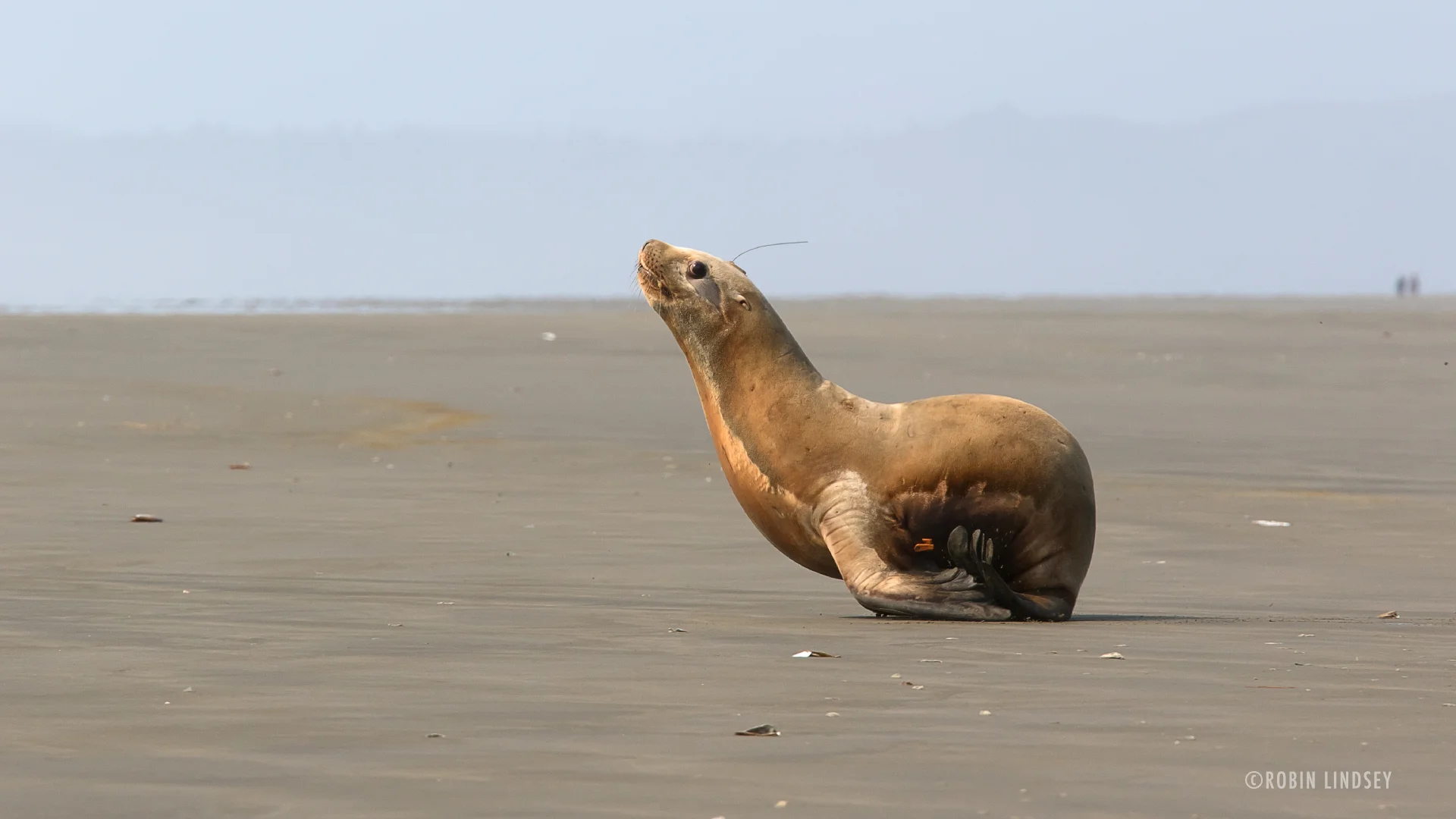
Banner photo: Leo Henderson makes a dash for the water. Photo courtesy of Robin Lindsey.